Seismology Network
The main research and monitoring resources in Seismology, in national level, are operated and maintained by the Department of Seismology (DS), in IGEO. The seismic instrumentation in Albania started in 1968, with the establishment of the first seismological station in Tirana. Formally, the Albanian Seismic Network (ASN) started in 1974, having a primary role of a local seismographic network to monitor the seismic activity in the country and issue seismic alerts to the authorities and general public. ASN improved after the '90-s to a broadband (BB) seismic network, contributing also to deeper scientific research in the local and regional Seismology, beyond what was already achieved. The actual configuration of ASN includes three sub-networks, namely:
- Weak-Motion Seismic Network (WMSN), for normal monitoring of Earthquakes;
- Strong-Motion Seismic Network (ASMN), to record ground motions produced by strong Earthquakes;
- Geodynamic network (GNSS), to record and assess the tectonic, co-seiscmic and post-seismic crustal movements;
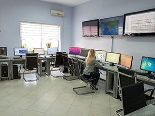
National Earthquake Monitoring Center
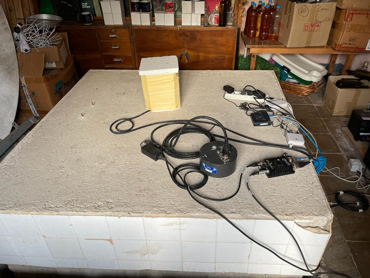
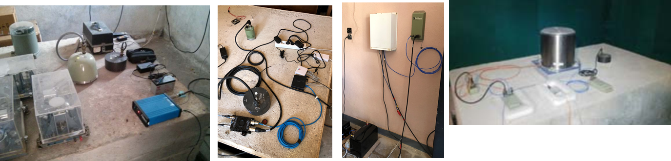
Trillium Compact 120 - Saranda Station
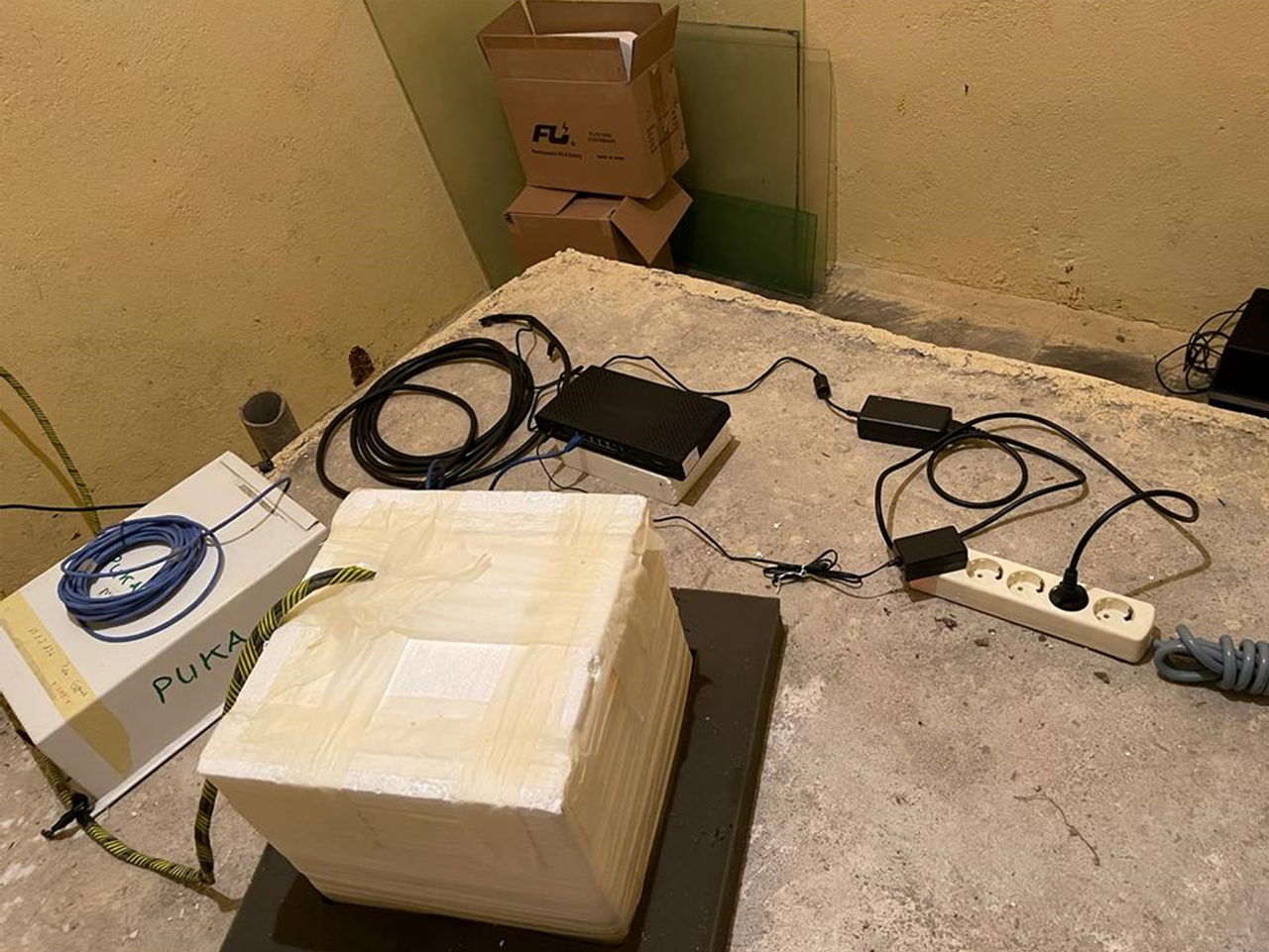
Guralp CMG 40T - Puka Station
Data transmission and Processing
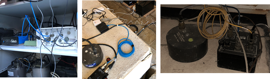
Seismic data is remotely transferred at the National Earthquake Monitoring Centre (NEMC), in IGEO, through terrestrial radio-link, 3G and 4G communication services. Data is processed and archived in real time through Seiscomp4 software with internal SeedLink server configuration. Same system is used to directly exchange data with homologous, partner institutions, on agreement basis. Offline data processing is also performed using SEISAN v. 12 seismic data analysis system, in connection to the Seiscomp4 data archive structure SDS, applying also automatic detection and location capabilities.
Seismic stations and station map
The current status include 12 broadband (BB) seismic stations of WMSN and ten more short-period (SP) stations (RESEAL Project contribution to improve the Albanian Seismic Network (ASN), within the efforts of the Government of Albania to improve the disaster risk management (DRM) system in the country); The actual broadband (BB) ASN’s WMSN stations are located at B. Curri (BCI), Puka (PUK), Peshkopia (PHP), Shkodra (SDA), Laci (LACI), Tirana (TIR), Berati (BERA), Korca (KBN), Vlora (VLO), Tepelena (TPE), Leskoviku (LSK) and Saranda (SRN).
ASMN numbers 17 accelerometric stations and GNSS numbers 10 permanent GPS stations; The actual accelerometric stations are located at B. Curri (BCI), Kukesi (KKS), Peshkopia (PHP), Shkodra (SDA), Laci (LACI), Durresi (DURR), Tirana (TIRA), Tirana (IGEO) coded TIR1, Fieri (FIER), Berati (BERA), Korca (KBN), Pogradeci (POGR), Vlora (VLO), Himara (HIMA), Tepelena (TPE), Leskoviku (LSK) and Saranda (SRN).
GNSS sub-network: Tirana (TIRA), Shkodra (SHKO), Himara (HIMA), Berati (BERA), Maliqi (MALI), Kryevidhi (KRYE), Kulla (KULL) and Orikumi, (ORIK).
Based on data exchange protocols, ASN makes use also of real time seismic data from neighbor regional networks, such as MedNet (MN), Aristotle University of Thessaloniki (AUTH-HT), National Institute of Geophysics and Volcanology (INGV-Rome), etc. (See more info).
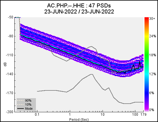
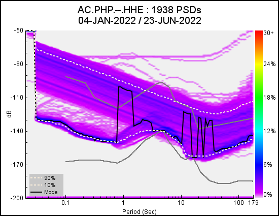
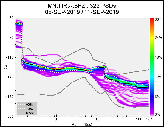
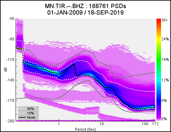
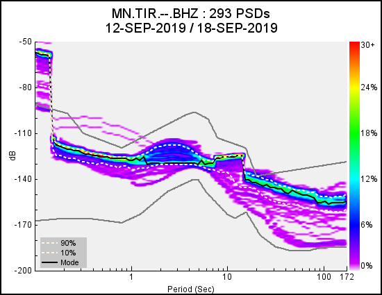
Seismic Stations Quality Check (QCH)
Instrumentation Resources
The Albanian National Seismic Network (ANSN) ) include 10 broadband (BB) seismic stations equipped with 30 sec, 40 sec, (0.033-100Hz) and 120 sec (0.0083-100Hz) seismic sensors, which constitutes the backbone of the National Seismic Network; The instrumentation is mainly Trillium-40 and Trillium-120CP, but also CMG-40T sensors are used in connection to the actual recording and transmission system, equipped by Trident-6 Channels digitisers and Cygnus data trsnscievers. Recently a fleat of 10 new seismic stations are part of ASN equipped with 1 sec short period geophones (SS10) and 10 triaxial accelerometers with variable gain, 0.5 – 4 g (SA10). A key instrumentation aspect is also the seismic mobile group equipped with 3 SENTINEL – Geo4G portable seisographs, based on internal MEMS accelerometers 1 – 8 g and integrated 4.5 Hz GeoPhones;
The strong motion component of ANSN include 16 accelerographs equipped mainly with CMG-5T accelerometers operating within the dynamic range 0.1-4g (the most configuration setting is 5V/1g), flat frequency response DC-100Hz and CMG-5TD type as a combination between 5T type accelerometer and DM24/3 (24-bit) digitizer. The new generation of accelerometric digitisers improving the Albanian Strong Motion Network (ASMN), which have been implemented already, will be Minimus-4 Channels (24-bit) and the future Fortimus smart digital broadband accelerometers.
The actual continuous permanent GNSS network of Albania comprises 8 permanent GPS stations
Remote control and data transfer is made via radio-link communication or mobile 3G (MALI and HIMA). Sampling rate used for all the stations is 30 sec.
After the November 26, 2019 Durresi Earthquake (Mw6.4), two additional stations were added to the sub-network, namely (KRYE) and (KULL), near to the hypocenter area.
Once per day the 24h-long and 30s-sampled binary file are extracted and archived in compact Rinex format rmat.
Applied instrumentation is based on Ashtech TopCon and Trimble technology.