
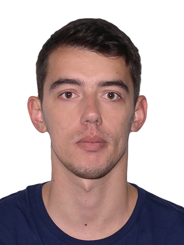
Msc. Eng
Amarildo
Shallas
Msc. Eng
Email:
a.shallas@geo.edu.al
Website:
geo.edu.al
Address:
Street “Don Bosko” no. 60,
Tirana
Albania
Postal Code:
1024
MSc. Eng. Amarildo Shallas is a Cartographer currently working in the Department of Geology at IGEO.
He obtained his Bachelor’s degree in Geography at the University of Tirana during the period 2014–2017. Later, he pursued his Master’s studies in Cartography and Geoinformatics at the Moscow State University of Geodesy and Cartography (MIIGAiK), graduating in 2020 with excellent results. His Master’s thesis focused on developing the mathematical foundation of maps using the Python programming language.
Professionally, he has gathered extensive experience in both the public sector and scientific research institutions.
In 2020, he worked briefly at the Municipality of Kolonja as a Specialist in the Department of Urban Development and Planning.
From February 2021 to April 2024, he served as a GIS Analyst at the Water Resources Management Agency, where he was mainly engaged in GIS research, development of web maps, and desktop applications for spatial data management.
From May 2024 to September 2025, he worked in the Department of Meteorology at IGEO, focusing on meteorological cartography, geospatial data analysis, and data visualization techniques to support scientific research and institutional services.
Since October 2025, he has been part of the Department of Geology at IGEO, where his work is oriented toward geological cartography, geospatial modeling, and the integration of GIS and programming tools for applied geosciences.
His areas of expertise include GIS, Cartography, Python programming, Spatial analysis, and WebGIS development, with a strong interest in applying innovative geospatial technologies in both environmental and geological research.